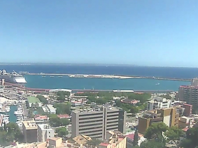
Palma. Panorama of Port de Palma
The panoramic camera in the southern part of the resort of Palma de Mallorca shows the urban development, as well as the main port of the city and the whole island. The first mention of navigation near the island was found in ancient documents dated to the 10th ˗ 11th centuries. Initially, the main port of Mallorca was located in the Bay of Porto Pi. The construction of a new transportation hub began with the erection of a large breakwater, which performed the role of a dock at the same time.
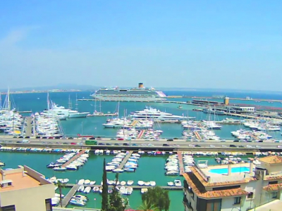
Port de Palma was opened in 1830 and, in 44 years, a significant expansion of the port began, due to heavy traffic. During the first half of the 20th century, fishing docks, berths for yachts and boats, a naval base, a western breakwater, and other components of the modern port were built. Even during the Second World War, the construction did not stop, for example, in 1944, Ribera de Sant Carles was opened.
At the beginning of the 21st century, the throughput capacity of the port was almost 1.5 million people a year. This number cannot be compared with the number of passengers at the local airport (in 2001, about 19 million people flew to the island), but arriving at the port on a cruise liner is a journey in itself.
The port is connected by sea to other popular resorts in Spain: Barcelona, Denia, Valencia, Formentera, Ibiza and Menorca.